---
title: "Alpe di Siusi"
type: "1day-itinerary"
lang: "en"
distance_km: 15
elevation_plus_m: 450
elevation_minus_m: 450
difficulty: "Medium"
duration_days: 1
url: "https://dolomites-guide.com/hiking-dolomites/alpe-di-siusi/"
description: "Alpe di Siusi (Seiser Alm) hiking guide 2026: plateau facts, ZTL driving ban, cable cars from Ortisei and Siusi, best trails and mountain huts."
---
# Alpe di Siusi
Experience the Alpe di Siusi (Seiser Alm), Europe's largest high-altitude alpine meadow. The Panorama Traverse offers a gentle yet spectacular circuit through emerald pastures, framed by the anvil-shaped Sciliar and the towering spires of the Sassolungo. Perfect for photographers and families alike.
## Overview
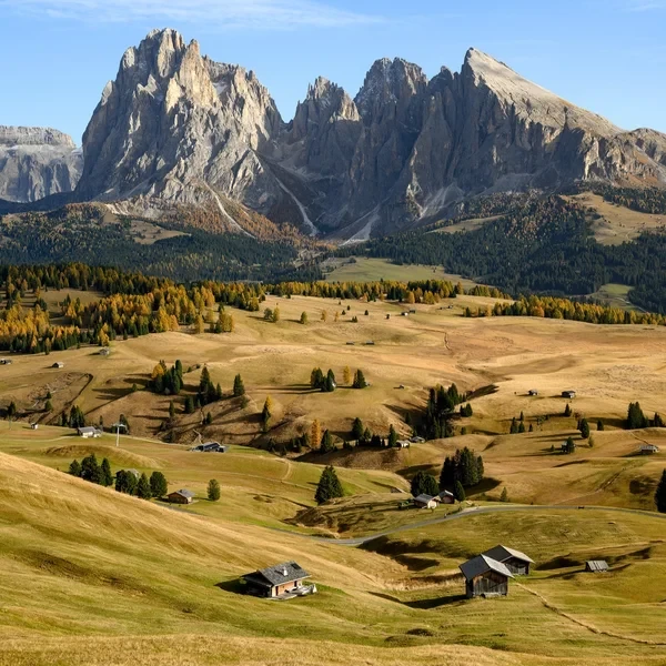
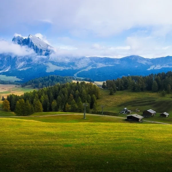
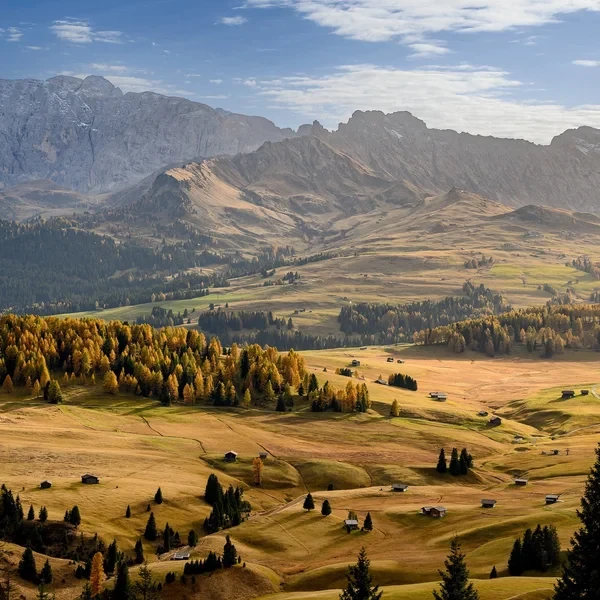
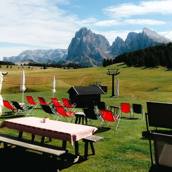
The Alpe di Siusi (Seiser Alm) is the largest high-altitude alpine meadow in Europe, spanning 56 square kilometers of rolling green pastures framed by the dramatic Sassolungo and Sciliar massifs. Unlike the jagged limestone peaks elsewhere in the Dolomites, this plateau offers a vast, open landscape that averages 1,850 m (6,070 ft) in elevation. The Panorama Traverse is a customizable circuit that provides a 'swivel seat' perspective of the region, making it the definitive destination for photographers, families, and hikers seeking world-class scenery without extreme vertical technicality.
## Stats
- Distance: 15 km
- Elevation gain: 450 m
- Elevation loss: 450 m
- Difficulty: Medium
- Duration: 1 day
## Need to know
## What is the Alpe di Siusi (Seiser Alm)?
The **Alpe di Siusi** - known in German as the **Seiser Alm** - is the largest high-altitude alpine meadow in Europe. It spans roughly **56 km² (22 sq mi)** of rolling pasture in the western Dolomites of South Tyrol, Italy, perched between the valleys of Val Gardena and Val d'Ega. Both names refer to the same place: Italian speakers use "Alpe di Siusi", German speakers use "Seiser Alm", and the bilingual Ladin region uses both interchangeably.
Unlike the jagged limestone towers that define most of the Dolomites, this is a vast, open plateau. Its meadows sit at an average altitude of 1,850 m (6,070 ft), rising from roughly 1,680 m (5,512 ft) at Compatsch to 2,350 m (7,710 ft) at the flanks of the Sassolungo. The plateau has been protected as part of the **Sciliar-Catinaccio Nature Park** since 1974, and forms part of the **UNESCO World Heritage Dolomites** inscribed in 2009.
The hiking season runs from **late May to early November**, aligned with the summer cable car operations from Ortisei and Siusi. Outside that window the plateau turns into a cross-country ski arena, but summer trails are buried and the shuttle buses stop running.
## Where is the Alpe di Siusi Located?
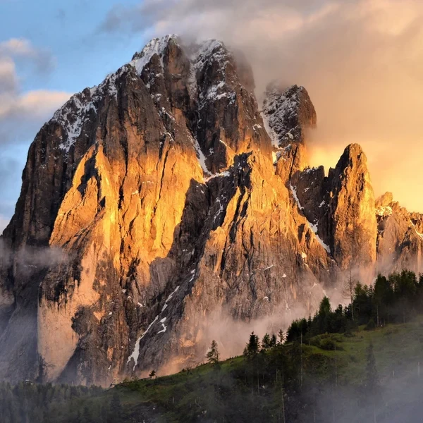
The Alpe di Siusi is situated in the western Dolomites, perched high above the villages of Ortisei (St. Ulrich), Siusi (Seis), and Castelrotto (Kastelruth). It functions as a natural amphitheater, with the massive, anvil-shaped **Sciliar (Schlern)** to the west and the towering spires of the **Sassolungo (Langkofel)** to the east.
The landscape seen today is not entirely natural; until roughly 800 years ago, it was a dense spruce forest that was cleared by hand to create the vast grazing pastures that define the Tyrolean agricultural tradition.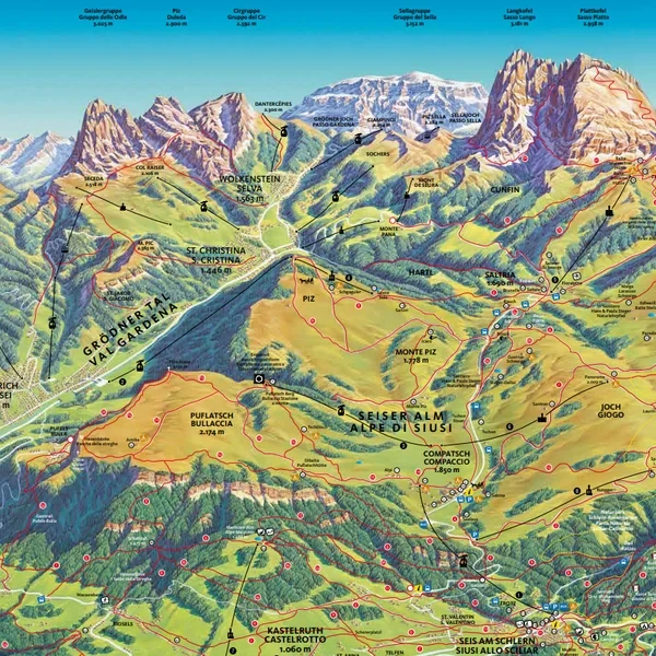For the full map, you can check the following [Alpe di Siusi Map](/images/alpe_de_siusi_full_map.pdf) made by the [SportHotel in the Dolomites](https://www.sporthotelsonne.com/it/alpedisiusi-escursioni/mappa-alpe-di-siusi/).
## Which Trail Experience Should You Choose?
With over 450 km (280 mi) of trails, the Alpe di Siusi can be overwhelming. The key is to choose a route based on the *type* of experience you want, not just distance. Here are the three definitive ways to experience the plateau, with precise starting logistics for each.
### Option #1: The "Grand Meadow" Panorama Traverse (The Icon)
- **The Goal:** To immerse yourself in the vastness of Europe's largest alpine meadow, completing a massive circuit of the central plateau.
- **The Route Data:**
- **Start/End:** Compatsch (Loop)
- **How to get to the start:** Take the blue **Seiser Alm Aerial Cableway** from the town of Siusi (Seis) up to Compatsch. The hike begins the moment you exit the top station.
- **Trail Sequence:** Compatsch -> Trail No. 7 (toward Hotel Panorama) -> Trail No. 6 (to Malga Sanon) -> Trail No. 9 (descend to Saltria) -> Trail No. 30 (Hans & Paula Steger Weg back to Compatsch).
- **Distance:** 15 km (9.3 mi)
- **Elevation:** +450 m (1,476 ft) ascent / -450 m (1,476 ft) descent.
- **The Reality:** This is the definitive full-day loop. You start at the Compatsch hub, hike deep into the plateau toward the towering Sassolungo, hit the valley floor at Saltria, and gently climb back out via the historic Hans & Paula Steger trail. It requires endurance, but the terrain consists entirely of wide gravel and paved paths.
### Option #2: The "Edge of the World" (Puflatsch / Bullaccia Circuit)
- **The Goal:** Dramatic, sheer-drop views that contrast with the flat meadow.
- **The Route Data:**
- **Start/End:** Compatsch (Loop)
- **How to get to the start:** Take the blue **Seiser Alm Aerial Cableway** from Siusi up to Compatsch. Walk 5 minutes to the Puflatsch Telemix (chairlift) to skip the initial climb, or just hike straight up Trail 14.
- **Trail Sequence:** Follow Trail No. 14 in a complete clockwise circle around the Puflatsch outcrop.
- **Distance:** 8 km (5 mi)
- **Elevation:** +250 m (820 ft) ascent / -250 m (820 ft) descent.
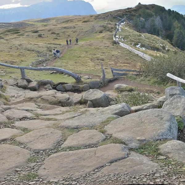
- **The Highlight:** Following Trail 14 leads you to the northern cliff edge and the **Hexenbänke (Witches’ Benches)**. These bizarre rock formations sit right on a vertical drop, offering a vertiginous 360-degree gaze down into the village of Castelrotto and across to the jagged Odle peaks.
### Is the Alpe di Siusi Stroller-Friendly?
**Yes, absolutely.** It is the most accessible high-alpine terrain in the Dolomites. Unlike the rocky paths of Tre Cime, many primary routes here are wide, hard-packed gravel or even paved service roads. The main corridor from **Compatsch toward Saltria** (following Trail No. 30 / the Hans & Paula Steger route) is perfectly suited for all-terrain strollers. For detailed trail recommendations by age group, see our [complete family hiking guide](/blog/dolomites-with-kids/).
## How to Get To Alpe di Siusi?
Access to the Alpe di Siusi is strictly regulated to protect the alpine environment. This is the most common point of confusion for visitors.
### The Compatsch Driving Ban (ZTL Rules)
For the 2026 season, the road leading from Siusi up to the plateau (Compatsch) is **closed to private traffic from 09:00 to 17:00**.
- **Early Access:** Drivers arriving before 09:00 may drive up and park at the P2 lot in Compatsch (approx. 28 EUR ($31)/day). However, the car must remain parked until 17:00. Moving a vehicle between huts on the plateau is strictly forbidden and monitored by automated cameras.
- **The Penalty:** Unauthorized driving within the ZTL (Zona Traffico Limitato) results in heavy fines. If you are not staying at a hotel on the plateau, do not attempt to drive up during the restricted window.
### Reaching the Plateau by Gondola
The most efficient way to access the trails is via the two primary cable car systems. Both run daily during the **summer season from 21 May to 1 November**, typically 08:30 to 18:00 (last descent around 18:30). Outside those dates, they close for two short maintenance windows and reopen for the winter ski season.
- **From Ortisei (Mont Sëuc Gondola):** This is the preferred choice for photographers. It lifts you from Ortisei (1,236 m (4,055 ft)) to the Mont Sëuc station at 2,005 m (6,578 ft) on the highest point of the northern ridge, offering the iconic "meadow and mountain" view of the Sassolungo. Do not confuse this with the separate **Furnes-Seceda** cable car, which also starts in Ortisei but goes to Seceda ridge, not to the plateau.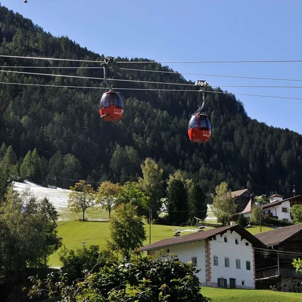
- **From Siusi allo Sciliar (Seiser Alm Gondola):** This lands in Compatsch, the main logistical hub of the plateau. The ride covers 4.3 km (2.7 mi) and 800 m (2,625 ft) of elevation in about 15 minutes. It is the best starting point for the Puflatsch circuit or for families requiring stroller-friendly paths.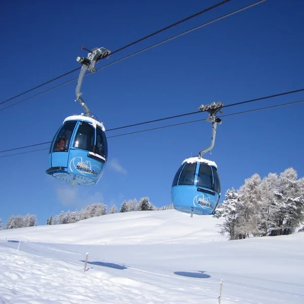
### Using the Alpe di Siusi Express (Bus 10)
If you miss the 09:00 driving cutoff and prefer not to use the gondola, the **Line 10 bus** departs from Siusi and Castelrotto. Note that during peak summer weeks, these buses reach capacity quickly. Reservations are not possible; it is a first-come, first-served system.
## When Should You Visit & How to Check Conditions?
### The Best Season: Blooms vs. Gold
- **Late June to Early July:** This is the "Bloom Window." The meadows are carpeted in alpine wildflowers (gentians, orchids, and rhododendrons). It is visually the most vibrant time to visit.
- **Late September to October:** The "Golden Season." The air is exceptionally clear, and the larch trees turn a brilliant yellow. The crowds disappear, and the temperatures are ideal for longer treks.
### How to Check the Weather
The plateau creates its own microclimate. Clouds often "sit" on the meadows even when the valleys are clear.
- **The Gold Standard:** Use the **Meteoblue** model. It is the only reliable source for predicting the "cloud ceiling" on the plateau.
- **Live Forecast:** We provide a real-time 7-day forecast specifically for the Alpe di Siusi below.
## What Essentials Must Be in Your Pack?
Do not let the "meadow" description lull you into a false sense of security. At an average elevation of **1,850 m (6,070 ft)** to **2,000 m (6,561 ft)**, the Alpe di Siusi is a high-alpine environment subject to rapid weather shifts and extreme UV exposure.
### Footwear: The "Morning Dew" Factor
Heavy, stiff leather mountaineering boots are overkill for the rolling terrain of the Alpe di Siusi and will only weigh you down.
- **The Recommendation:** Lightweight "Approach Shoes" or sturdy trail runners are the optimal choice.
- **The Wet Grass Trap:** If you hike early in the morning, the tall alpine grass will be soaked in heavy dew. Non-waterproof mesh sneakers will leave you with freezing, wet feet by 09:00. Opt for a shoe with a Gore-Tex (GTX) membrane and a lugged sole, as wet grass on a descent is incredibly slippery.
### Sun Protection: The "Meadow" Risk
Unlike the forested valleys below, the central plateau is almost entirely devoid of tree cover. You will be exposed to direct sunlight for the entire duration of your hike.
- **The Invisible Threat:** The cool alpine breeze often masks the heat, leading hikers to underestimate the sun. At this altitude, UV radiation is roughly 20% stronger than at sea level.
- **Mandatory Gear:** SPF 50+ sweat-resistant sunscreen (reapplied every two hours), a wide-brimmed hat, and Category 3 sunglasses.
### Clothing Strategy: The Thunderstorm Rule
The Alpe di Siusi is notoriously prone to rapid, violent afternoon thunderstorms, particularly in July and August.
- **The Lightning Hazard:** On a flat, open plateau, you are often the tallest object around. You do not want to be caught miles from a hut in a storm.
- **The Layering System:** Always pack a lightweight, fully waterproof hard-shell jacket (not just a windbreaker). Bring a moisture-wicking synthetic base layer; avoid cotton, which stays wet and cold when the wind picks up.
### Hydration & Hut Logistics
Because the plateau is dotted with world-class mountain huts (*Schwaigen*), you do not need to carry a heavy backpack full of meals.
- **Water:** While there are huts, the walking distances between them across the vast meadow are deceiving. Carry at least **1.5 l (50 fl oz)** of water per person. The dry mountain air accelerates dehydration silently.
- **Cash is King:** Many smaller huts and dairy farms selling fresh yogurt or cheese do not accept credit cards, or their satellite terminals fail during cloudy weather. Carry approximately 40 EUR ($44) in mixed bills, plus a handful of 1 EUR ($1) and 2 EUR ($2) coins. You will need these coins if you decide to take the internal shuttle buses (like the Saltria-Compatsch bus) to cut your hike short.
## What are the Culinary Highlights?
The Alpe di Siusi is widely considered the gastronomic heart of the Dolomites. Unlike the rugged, high-altitude stone shelters found on peaks like Tre Cime, the huts here are known as *Schwaigen* (traditional Tyrolean dairy farms). Because the plateau has a rich agricultural history, the culinary quality rivals high-end valley restaurants.
### The "Must-Visit" Mountain Huts
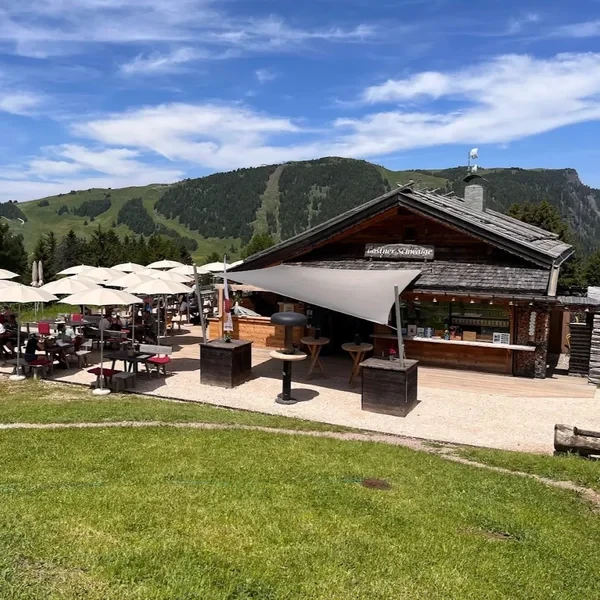
- **Gostner Schwaige:** This tiny, rustic hut is a true culinary destination. Chef Franz Mulser is famous across the region for his "Heusuppe" (Hay Soup). It is served in a hollowed-out bread bowl and brewed using over 15 different alpine herbs and edible flowers harvested directly from the surrounding pastures. Seating is extremely limited.
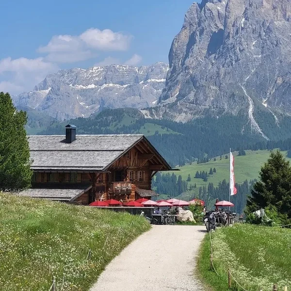
- **Rauchhütte:** If you want a premium dining experience, this is the location. Run by the same family for over a century, Rauchhütte offers an extensive South Tyrolean wine cellar that completely defies its alpine setting. Pair a glass of local Lagrein wine with their locally sourced venison, all while sitting on a terrace that perfectly frames the Sassolungo.
- **Malga Sanon:** The ultimate stop for traditional Tyrolean comfort food. Nestled deep in the rolling plateau, it is the perfect place to reward yourself with *Kaiserschmarrn*. This fluffy, caramelized, shredded pancake is served piping hot in a cast-iron pan with homemade plum compote or apple sauce.
### The Peak Season Dining Trap
Do not expect to walk into these highly rated huts at 13:00 in mid-July or August and find a table. If you want a seated lunch on the terrace at Gostner Schwaige or Rauchhütte during the summer, you must call them to make a reservation several days in advance. If you do not have a booking, plan to eat your main meal exactly at 11:30 or wait until after 14:30.
## Practical info
- Best season: Mid-June to Mid-October
- Accommodation: Numerous hotels in Compaccio and Saltria
- Navigation: Easy (Follow signs for Hans and Paula Steger Weg)
- Gear: Comfortable walking shoes, sun protection, light layers
- Start Point: Compaccio (via Siusi Gondola) or Mont Sëuc (via Ortisei)
- End Point: Compaccio (Loop)