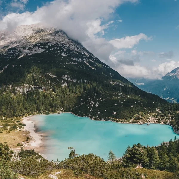
Lago di Sorapis
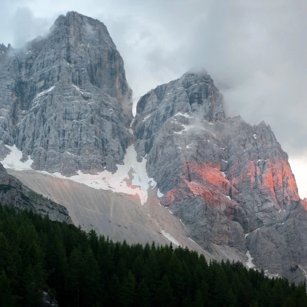
Lago di Sorapis is a glacial lake at 1,925 m6,316 ft in the Sorapis group near Cortina d'Ampezzo (Anpezo). CAI Trail 215 from Passo Tre Croci covers 12.6 km7.8 mi round trip with 630 m2,067 ft of elevation gain through forest, scree, and cable-aided rock traverses. The lake's milky turquoise color comes from suspended glacial sediment. Medium difficulty - the cable-aided sections demand sure-footedness and a head for heights.
Table of Contents
Where Is Lago di Sorapis?
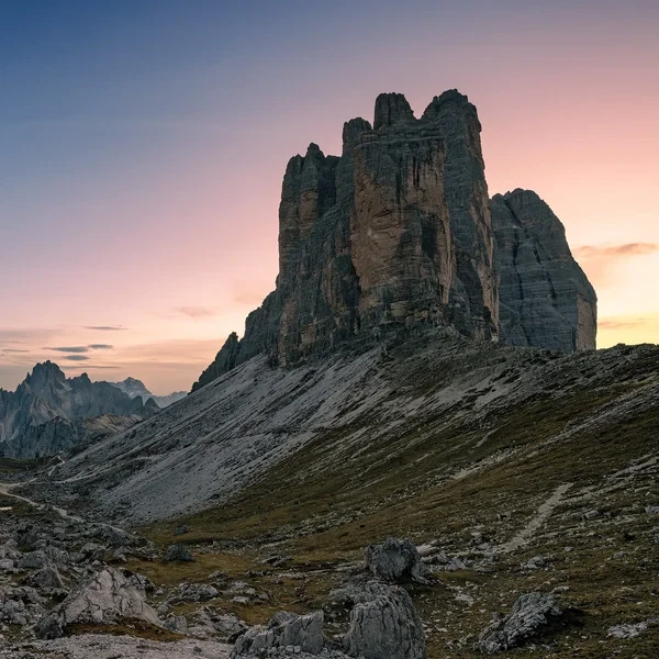
Lago di Sorapis sits in a tight cirque beneath the north face of the Sorapis group, the second-highest massif in the Ampezzo Dolomites at 3,205 m10,515 ft. The lake is hidden - you cannot see it from any road or valley. The only access is on foot via CAI Trail 215, which starts from Passo Tre Croci (1,805 m5,922 ft), a pass on the road between Cortina d'Ampezzo (Anpezo) and Misurina.
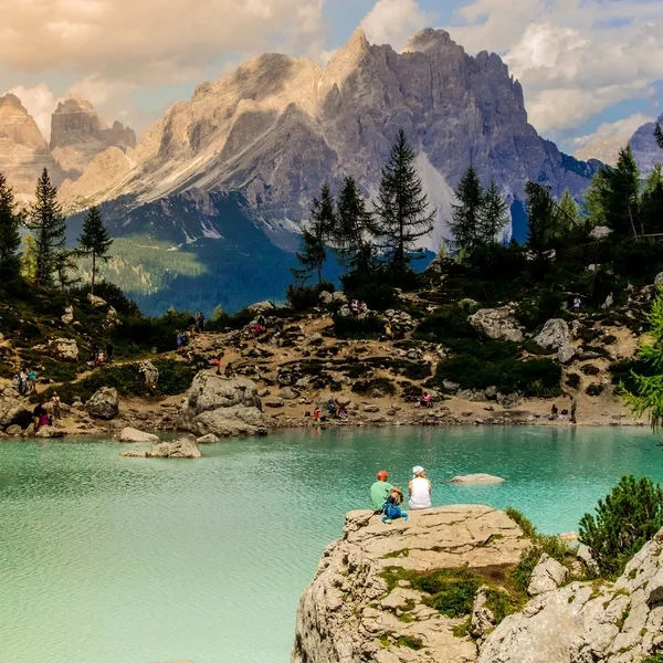
The Dito di Dio (Finger of God) - a freestanding rock spire rising directly from the lake's southeast shore - is the landmark you will recognize from every photograph. The lake itself owes its unreal color to suspended glacial sediment (rock flour) from the Sorapis glacier remnants above. The color shifts with light and season: deep turquoise in morning shade, milky aquamarine under direct sun.
Which Trail Should You Take?
Option #1: Classic Out-and-Back (CAI 215)
- The Goal: Reach the lake by the most direct route and return the same way.
- The Route Data:
- Start/End: Passo Tre Croci car park (1,805 m5,922 ft)
- Trail Sequence: CAI 215 (also signed locally as S2) from Passo Tre Croci to Rifugio Vandelli, then 5-minute descent to the lakeshore
- Distance: 12.6 km7.8 mi round trip
- Elevation: +630 m2,067 ft ascent / -620 m2,034 ft descent
- Walking Time: 4.5-5.5 hours total (2-2.5 hours each way)
- The Reality: The first 45 minutes through forest are deceptively easy - a smooth, gently climbing path that gives no hint of what follows. After the treeline thins, the trail narrows and traverses exposed scree slopes with fixed steel cables and metal pegs hammered into the rock face. One section - the Cengia del Banco - is a narrow ledge with a vertical drop to the left and a cable bolted to the wall on the right. It is not technical climbing, but if you freeze on exposed terrain, this is not your hike. The bottleneck here in peak season creates 15-20 minute queues on the cables. Start early or accept the wait.
Option #2: Extended Loop via Forcella Faloria
- The Goal: Avoid retracing your steps by returning via Forcella Faloria and the Faloria cable car.
- The Route Data:
- Start: Passo Tre Croci car park (1,805 m5,922 ft)
- End: Faloria cable car top station (2,123 m6,965 ft), then cable car to Cortina
- Trail Sequence: CAI 215 to Rifugio Vandelli, then CAI 216/217 over Forcella Faloria, descent to Faloria station
- Distance: 14.5 km9 mi one-way
- Elevation: +850 m2,790 ft ascent / -530 m1,740 ft descent
- Walking Time: 6-7 hours
- The Reality: This adds 3 km1.9 mi and roughly 90 minutes but rewards you with completely different scenery on the return - open ridgeline views across the Ampezzo basin toward Tofane and Cristallo. The Forcella Faloria saddle offers one of the best panoramic viewpoints in the entire Cortina area. You need to arrange transport back to Passo Tre Croci from Cortina (bus Line 30 or taxi). The Faloria cable car operates roughly mid-June to late September - verify dates before committing to this route.
How to Get to Passo Tre Croci?
Passo Tre Croci is on the SR48 road between Cortina d'Ampezzo and Misurina. From Cortina, it is a 15-minute drive east.
Parking
The car park at Passo Tre Croci is small - roughly 30-40 spaces on a gravel lot directly at the pass. By 08:00 on any day between mid-July and late August, it is full. Do not expect to find a space if you arrive after 08:30 in peak season. Additional overflow parking exists along the road shoulders, but police ticket aggressively when cars block traffic flow.
Bus Access
Dolomiti Bus Line 30 (Cortina - Misurina - Auronzo) stops directly at Passo Tre Croci. In summer, departures from Cortina bus station run approximately every 60-90 minutes starting around 07:30. The ride takes 20 minutes. Check current timetables at dolomitibus.it - schedules change yearly. A single ticket costs approximately EUR 3-4.
If you are using the Südtirol Mobilcard, note that it does NOT cover Dolomiti Bus routes in the Belluno province (Cortina is in Veneto, not South Tyrol). You need separate tickets.
When Should You Visit and How to Check Conditions?
The Best Window
Mid-June to early October, but the sweet spot is late June to mid-September. Before mid-June, snow patches often block the cable-aided sections and make the trail dangerous. After early October, the first snowfalls can arrive without warning, and Rifugio Vandelli closes for the season.
July and August deliver the most reliable weather but also the worst crowds. Expect 300-500 people on the trail per day in peak weeks. The cable sections become a genuine bottleneck.
September is the best compromise - stable weather, golden larch forests, and roughly a third of the summer traffic. The lake color tends to be more intense in early autumn as glacial melt slows and sediment concentration changes.
Time of Day
Start by 07:00 at the latest. This is not optional advice - it is the difference between a good experience and a miserable one. Early starts give you the lake in morning shade (deeper color), empty cables, and you are descending before the afternoon thunderstorms that hit the Sorapis group with clockwork regularity from late June through August. If you reach the lake by 09:30, you will have it nearly to yourself for 30-45 minutes before the main wave arrives.
How to Check the Weather
Use Meteoblue's multi-model forecast for Passo Tre Croci. Pay attention to the "predictability" bar - when models disagree, the weather is unstable and you should have an escape plan. We provide a real-time forecast below.
What Rules Apply at the Lake?
Swimming is banned. The turquoise color that draws people here exists because the water is an undisturbed glacial system. Swimming, wading, and even touching the water surface are prohibited. Fines start at EUR 200. Rangers patrol the shore regularly in summer - this is enforced, not a suggestion.
Drones are banned. The Sorapis cirque is inside the Parco Naturale delle Dolomiti d'Ampezzo. Flying drones without a specific permit from the park authority is illegal. Again, enforced with on-site rangers.
Dogs must be leashed at all times on the trail and at the lake.
What About Rifugio Vandelli?
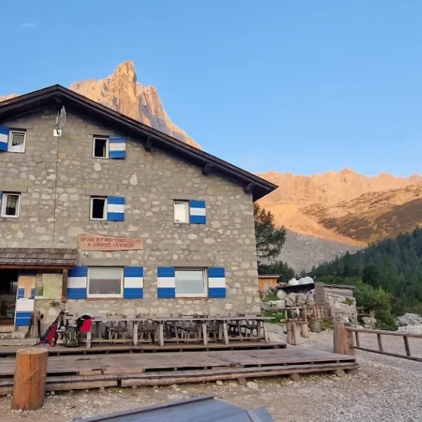
Rifugio Alfonso Vandelli sits at 1,928 m6,325 ft, roughly 10 minutes above the lake on a rocky shelf. It serves hot meals from late June to late September (verify current season dates). Half-board overnight stays are available if you want to catch sunrise at the lake - a strategic move that lets you experience the cirque without another soul present. Book well in advance; this is one of the most requested huts in the Cortina area.
The rifugio is also a stop on the Alta Via 1 long-distance route. Through-hikers on the AV1 typically arrive from Rifugio Palmieri (Son Forca) and continue toward Passo Tre Croci the following morning. If you are considering the full Alta Via 1, Sorapis makes an excellent preview of the terrain and logistics involved.
For a deeper dive into how rifugios work - booking systems, what to bring, etiquette, and pricing - see our mountain hut guide.
What to Pack?
Footwear
The Recommendation: Sturdy trail runners with aggressive grip or lightweight approach shoes. The cable sections involve stepping on metal pegs and smooth rock - you need rubber that grips on polished limestone. Standard running shoes or fashion trainers are dangerous here. Trekking poles are highly recommended for the cable-aided descent - they take pressure off your knees on the steep, loose sections and help with balance on the exposed traverses.
Sun Protection
The Invisible Threat: The trail is partially shaded through forest, but the lake cirque is a natural sun trap - pale limestone reflects UV from every direction. SPF 50+ sunscreen, reapplied after the climb. Category 3 sunglasses. A peaked cap or wide-brim hat. At 1,900 m6,230 ft, UV radiation is roughly 15-20% stronger than at sea level, and the reflected light off the pale rock doubles your effective exposure.
Clothing Strategy
Start in a light layer - the forest climb generates heat. Carry a wind-resistant mid-layer and a packable rain jacket. Afternoon thunderstorms in the Sorapis group are not a possibility - they are a near-certainty in July and August. Temperature at the lake can drop 10°C18°F in minutes when clouds roll in.
Hydration and Food
Carry at least 1.5 l50 fl oz of water. There is no reliable water source between Passo Tre Croci and Rifugio Vandelli. The rifugio sells drinks and hot meals - expect to pay EUR 10-15 for a plate of pasta or polenta. Verify current pricing at the hut, as rates adjust yearly. Cash is the safest option - the card terminal depends on a satellite link that fails in bad weather.
How to Get the Best Photos?
The lake's Instagram fame is earned, but most posted photos look identical because people arrive at the same time and shoot from the same spot. Here is how to do better.
Best light: Early morning (07:30-09:30) when the cirque walls are in shadow but the lake surface catches indirect light. This is when the turquoise color is deepest and most saturated. Direct midday sun washes out the color and creates harsh reflections.
Best angle: The obvious viewpoint is the main shore where the trail arrives. For a more dramatic composition, scramble carefully along the east shore (marked with faint cairns) to position the Dito di Dio as a foreground element with the Sorapis glacier remnants behind. This angle is rarely photographed because most visitors do not venture past the main beach area.
Golden hour: If you are staying at Rifugio Vandelli overnight, the 30 minutes after sunrise turns the east-facing cliffs above the lake a deep orange. The lake is in full shadow at this point, creating a striking contrast between warm rock and cold blue water.
Gear note: A polarizing filter cuts the surface reflections and intensifies the turquoise. On a phone, shoot in the morning shade for the same effect naturally.
What Else Is Nearby?
If you are spending multiple days in the Cortina area, Lago di Sorapis pairs well with the Tre Cime di Lavaredo loop - a 30-minute drive from Passo Tre Croci to the Auronzo refuge car park. Doing both hikes on consecutive days gives you two of the most iconic landscapes in the Dolomites from a single base. For seasonal planning, check our best time to visit the Dolomites guide.
Practical Info
We organize the logistics so you can focus on the trail. Get in touch with our experts today.
Direct contact with local Dolomites experts
Explore More Treks
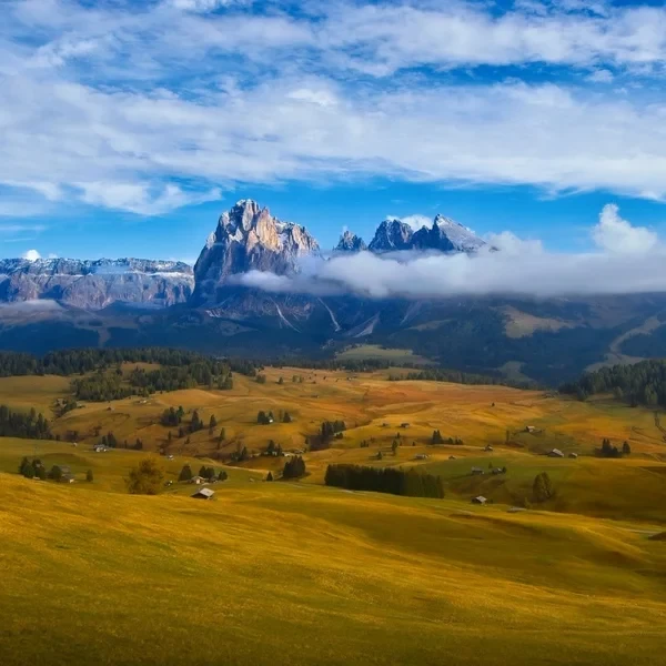
Alpe di Siusi
Experience the Alpe di Siusi (Seiser Alm), Europe's largest high-altitude alpine meadow. The Panorama Traverse offers a gentle yet spectacular circuit through emerald pastures, framed by the anvil-shaped Sciliar and the towering spires of the Sassolungo. Perfect for photographers and families alike.
Alta Via 1
The definitive multi-day journey across the heart of the Dolomites. Spanning 120 km74.6 mi of rugged limestone terrain, this classic trek takes you from the emerald waters of Lago di Braies to the historic streets of Belluno, staying in world-class mountain huts along the way.
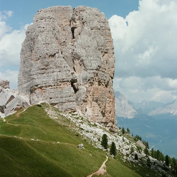
Cinque Torri Loop & WWI Open Air Museum
Explore one of the most famous rock formations in the Dolomites. This guide covers the WWI trenches, the loop around the five towers, and the climb to the historic Rifugio Nuvolau.
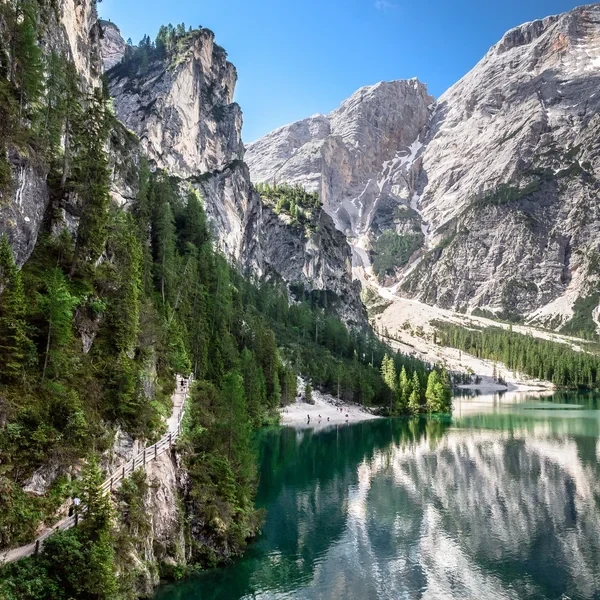
Lago di Braies
Visit the most famous lake in the Italian Dolomites. This guide covers the essential shoreline loop, the easy hike to Malga Foresta, and critical 2026 parking and shuttle regulations.
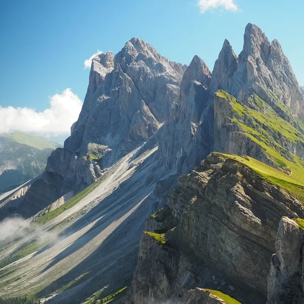
Seceda Ridgeline
Walk the most iconic ridgeline in the Dolomites, tracing the spine of the Odle massif above Val Gardena. Choose between a short summit loop from the gondola (4 km2.5 mi) or a full-day circuit via Monte Pic da Cristauta (13.1 km8.1 mi), both with continuous views of the Geisler spires.
Tre Cime di Lavaredo Loop
Circle the most iconic monoliths in the Alps. This essential day hike brings you face-to-face with the dramatic north faces of the Three Peaks, traversing high-altitude scree fields and historic WWI tunnels in the heart of the Sesto Dolomites.
From our partner · 400+ Verified Traveler Reviews
"This trek is magnificent. The itinerary is perfect, and our guide was extraordinary - knowledgeable, attentive, and genuinely passionate about the Dolomites."
"Well-marked trails that avoid the crowded tourist spots, with real elevation changes that keep it interesting. The mountain hut stays were a highlight - the Italian food at every rifugio was outstanding."
"Our guide was super professional. The transportation was seamless, and the family-run hotel was very comfortable - a friendly and safe setting. I would do it again in a minute."
"Excellent itinerary, excellent guide. Every detail was handled perfectly and the route choices were spot on. Would do it again without hesitation."
"A spectacular trek through an exceptional mountain range. The route avoids the most crowded areas and the views are relentless. Be warned - the elevation changes are more demanding than you expect."
"A genuinely engaging trek that keeps you motivated day after day. The variety of landscapes - from green valleys to high rocky passes - is remarkable. Well organized from start to finish."
"I rate this trip 10 out of 10. The accommodation quality exceeded my expectations, and the staff were incredibly attentive - even accommodating my food allergies without any fuss."
"An extraordinary itinerary that lets you discover the Dolomites without overexerting yourself. The route is well-balanced with no technical difficulties, yet you still feel immersed in the high mountains."
"A great discovery for a first group hiking trip. The guide was excellent, the group was friendly, and the autumn weather gave us clear skies over the Dolomites nearly every day."
"A wonderful week in the mountains with an excellent guide who knew every trail and every shortcut. The hut-to-hut format made the logistics effortless - just walk and enjoy."
Decades of Alpine Expertise
Our partner agency has been operating in the Alps for over 40 years. Their team of passionate mountain experts knows every trail, every rifugio, and every season intimately.
Fully Protected Trips
Your investment is safe. We work exclusively with a licensed, bonded, and insured operator. 24/7 assistance and comprehensive travel insurance are included with every booking.
Handcrafted by Locals
No generic packages. Each itinerary is designed by a small team of travel experts who hike these trails themselves. Luggage transfers, dietary needs, and every logistical detail are handled for you.
A Real Team, Not a Call Center
A dedicated team of a dozen specialists is available before, during, and after your trip. You speak directly to the people who designed your route and know the terrain.