Dolomites Hikes
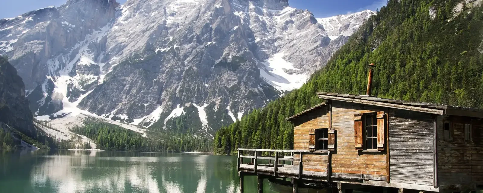
Discover the breathtaking trails of the Italian Dolomites.
Alpe di Siusi
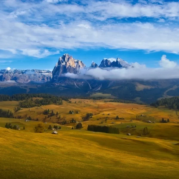
Experience the Alpe di Siusi (Seiser Alm), Europe's largest high-altitude alpine meadow. The Panorama Traverse offers a gentle yet spectacular circuit through emerald pastures, framed by the anvil-shaped Sciliar and the towering spires of the Sassolungo. Perfect for photographers and families alike.
Alta Via 1
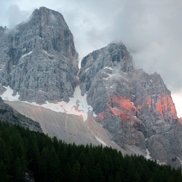
The definitive multi-day journey across the heart of the Dolomites. Spanning 118 km73.3 mi of rugged limestone terrain, this classic trek takes you from the emerald waters of Lago di Braies to the historic streets of Belluno, staying in world-class mountain huts along the way.
Cinque Torri Loop & WWI Open Air Museum
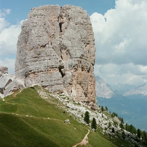
Explore one of the most famous rock formations in the Dolomites. This guide covers the WWI trenches, the loop around the five towers, and the climb to the historic Rifugio Nuvolau.
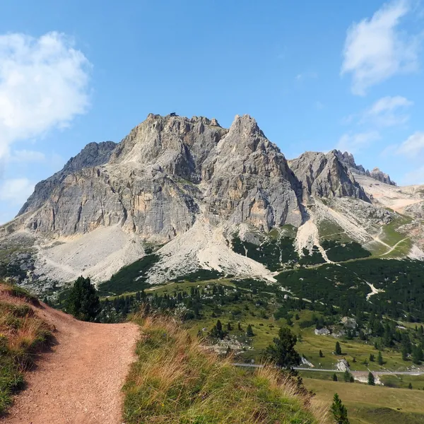
Lagazuoi - Loop from Armentarola & Great War Tunnel
The walking loop from Armentarola via the Forcella Lagazuoi, the lake and Rifugio Scotoni, or the Passo Falzarego cable car and the descent through the Great War tunnel.
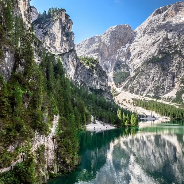
Lago di Braies
Visit the most famous lake in the Italian Dolomites. This guide covers the essential shoreline loop, the easy hike to Malga Foresta, and the 2027 parking and shuttle regulations.
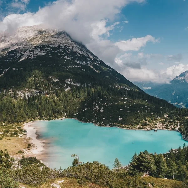
Lago di Sorapis
A glacial turquoise lake hidden beneath the Sorapis massif near Cortina d'Ampezzo. The trail from Passo Tre Croci crosses cable-aided rock traverses to reach one of the most photographed spots in the Dolomites.

Odle and Adolf Munkel Trail - Loop from Zannes in Val di Funes
A loop from the Zannes car park, in Val di Funes, along the Adolf Munkel Trail in the Puez-Odle park: the long version, the short version, and how to park or come by bus.
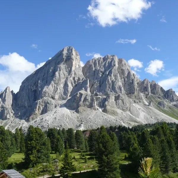
Sass de Putia Loop - Circuit via the Passo delle Erbe
The full Sass de Putia loop via the Passo delle Erbe, in the north of the Puez-Odle park: the climb to the Forcella, the huts on the east side, the short version and access by car or bus.
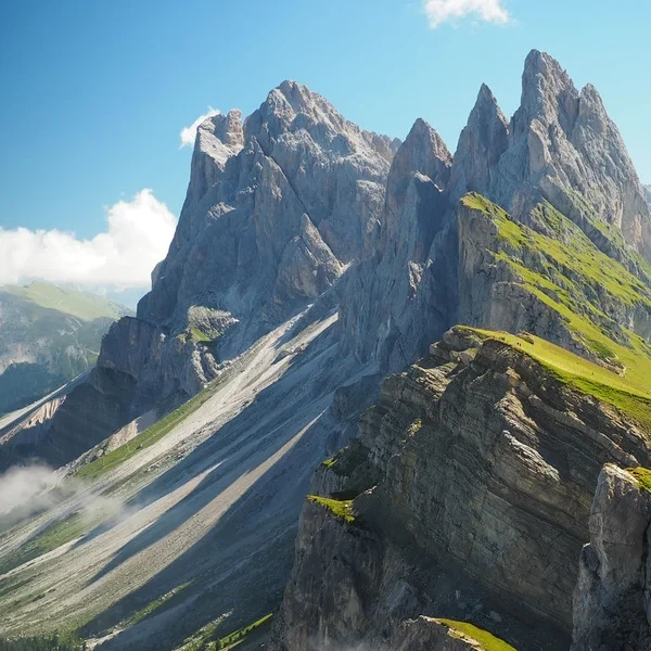
Seceda Ridgeline
Walk the most iconic ridgeline in the Dolomites, along the spine of the Odle above Val Gardena. Choose a short loop from the gondola (4 km2.5 mi) or a full-day circuit via Monte Pic da Cristauta (12.8 km8 mi), facing the Geisler spires.
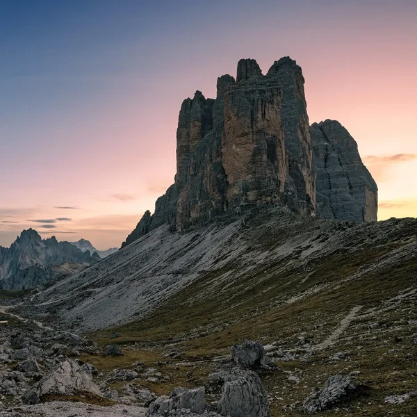
Tre Cime di Lavaredo Loop
Circle the most iconic monoliths in the Alps. This essential day hike brings you face-to-face with the dramatic north faces of the Three Peaks, traversing high-altitude scree fields in the heart of the Sesto Dolomites.
No itineraries match your search.
Hiking the Dolomites - Frequently Asked Questions
When is the best time to hike in the Dolomites?
The hiking season runs from mid-June to late September, depending on the huts. July and August deliver the most stable weather, but trails on popular routes like the Alta Via 1 are packed. September is the sweet spot: thinner crowds, crisp air, golden larch forests. Early June is a gamble - snow can linger at altitude and huts do not all open on the same date.
Do I need to be very fit to hike in the Dolomites?
It depends entirely on the route. A day hike around the Tre Cime di Lavaredo or a loop on the Alpe di Siusi requires normal fitness - anyone who walks regularly can manage it. Multi-day routes like the Alta Via 1 (about 125 km78 mi, 7,300 m23,950 ft of elevation gain, twelve stages) demand solid cardiovascular endurance and confidence on exposed terrain with steel cables. If you cannot comfortably hike 6 to 8 hours with 800 m2,625 ft of elevation gain carrying a 6 kg pack, train for at least 8 weeks before attempting it.
What is a via ferrata and do I need one?
A via ferrata ('iron road') is a protected climbing route with steel cables, ladders, and metal rungs bolted into the rock. Some Dolomites itineraries cross short via ferrata sections that require a harness, via ferrata set (with energy absorber), and helmet. You can rent the full kit at sport shops in the valleys. If your route includes harder via ferrata sections, prior experience or a certified mountain guide is strongly recommended.
How do I get to the Dolomites trailheads?
Fly into Venice Marco Polo (VCE), Innsbruck (INN), or Verona (VRN). Public transport exists but some lines are seasonal: the Cortina Express bus links Venice airport to Cortina d'Ampezzo, and the südtirolmobil lines serve the South Tyrol valleys. A car is useful, but not essential: line 444 serves Rifugio Auronzo from Dobbiaco in season.
Should I book a guided trek or go self-guided?
If you have multi-day hiking experience, can read a trail map, and are comfortable with basic route-finding, self-guided works perfectly - the trails are well-marked. Choose guided if you want via ferrata sections without owning gear, if it is your first time above 2,500 m8,202 ft, or if you simply want someone else to handle hut bookings, luggage transfers, and daily briefings.
What should I pack for a multi-day Dolomites trek?
Keep your pack under 7 kg (excluding water). Essentials: waterproof jacket (not optional - afternoon thunderstorms are frequent in July and August), mid-layer fleece, hiking trousers, 2 moisture-wicking base layers, sun hat, sunglasses (Category 3+), sunscreen SPF 50, headlamp, basic first aid kit, and a sleeping bag liner (mandatory in the huts of the alpine clubs: Alpenverein Südtirol, CAI - they provide blankets but not sheets). Trekking poles save your knees on the 1,000 m3,281 ft descents. Leave the camping gear at home - you are sleeping in huts.
How dangerous are the trails in the Dolomites?
Most marked trails are safe for experienced hikers. The real risks are weather and terrain, not technical difficulty. Thunderstorms develop rapidly above 2,500 m8,202 ft - check Meteoblue the night before and start early. Wet limestone becomes extremely slippery, and exposed ridgelines are dangerous during electrical storms. Rockfall is a concern on certain sections, on scree-heavy descents. Stick to marked paths, carry a charged phone with offline maps (Mapy.cz), and never hike alone on exposed routes.
From our partner · 400+ Verified Traveler Reviews
"This trek is magnificent. The itinerary is perfect, and our guide was extraordinary - knowledgeable, attentive, and genuinely passionate about the Dolomites."
"Well-marked trails that avoid the crowded tourist spots, with real elevation changes that keep it interesting. The mountain hut stays were a highlight - the Italian food at every rifugio was outstanding."
"Our guide was super professional. The transportation was seamless, and the family-run hotel was very comfortable - a friendly and safe setting. I would do it again in a minute."
"Excellent itinerary, excellent guide. Every detail was handled perfectly and the route choices were spot on. Would do it again without hesitation."
"A spectacular trek through an exceptional mountain range. The route avoids the most crowded areas and the views are relentless. Be warned - the elevation changes are more demanding than you expect."
"A genuinely engaging trek that keeps you motivated day after day. The variety of landscapes - from green valleys to high rocky passes - is remarkable. Well organized from start to finish."
"I rate this trip 10 out of 10. The accommodation quality exceeded my expectations, and the staff were incredibly attentive - even accommodating my food allergies without any fuss."
"An extraordinary itinerary that lets you discover the Dolomites without overexerting yourself. The route is well-balanced with no technical difficulties, yet you still feel immersed in the high mountains."
"A great discovery for a first group hiking trip. The guide was excellent, the group was friendly, and the autumn weather gave us clear skies over the Dolomites nearly every day."
"A wonderful week in the mountains with an excellent guide who knew every trail and every shortcut. The hut-to-hut format made the logistics effortless - just walk and enjoy."
Decades of Alpine Expertise
Our partner agency has been operating in the Alps for over 40 years. Their team of passionate mountain experts knows every trail, every rifugio, and every season intimately.
Fully Protected Trips
Your investment is safe. We work exclusively with a licensed, bonded, and insured operator. 24/7 assistance and comprehensive travel insurance are included with every booking.
Handcrafted by Locals
No generic packages. Each itinerary is designed by a small team of travel experts who hike these trails themselves. Luggage transfers, dietary needs, and every logistical detail are handled for you.
A Real Team, Not a Call Center
A dedicated team of a dozen specialists is available before, during, and after your trip. You speak directly to the people who designed your route and know the terrain.