Why is Alta Badia a great base for hiking the Ladin Dolomites?
The first thing to understand about Alta Badia (Hochabtei) is that it is not German South Tyrol, despite sitting inside the Province of Bolzano. The Val Badia (Gadertal) and its surrounding villages - Corvara in Badia, Colfosco (Kolfuschg), La Villa (Stern), San Cassiano (St. Kassian), Badia (Abtei), and La Val (Wengen) - belong to the Ladin Dolomites, a distinct cultural and linguistic zone where the ancient Rhaeto-Romance language Ladin survives as a living tongue. Road signs appear in three languages simultaneously: Italian, German, and Ladin. If a local addresses you in none of those three, do not be surprised. This cultural specificity is not a tourist attraction - it is simply how things work here.
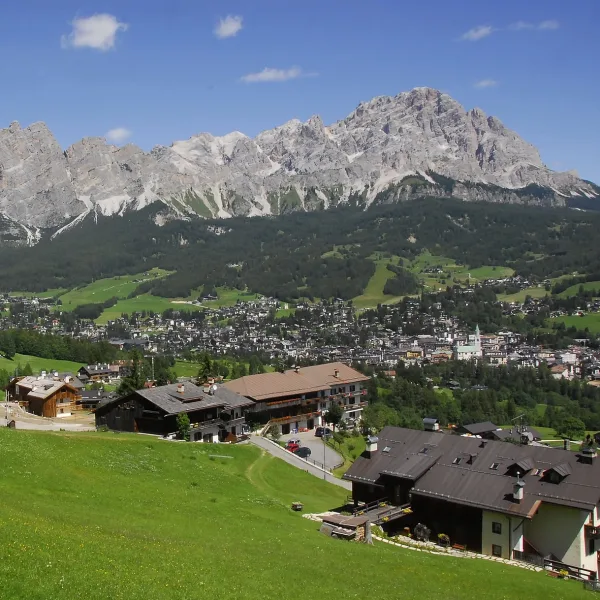
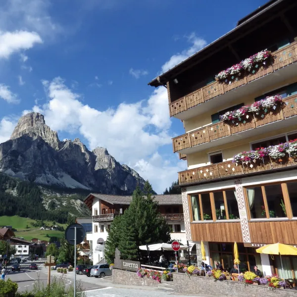
At 1,568 m5,144 ft, Corvara is the highest village base among the five major Dolomites hiking towns, sitting roughly 350 m1,148 ft higher than Cortina d’Ampezzo. That extra altitude changes the character of hiking entirely. The trails around Corvara start high, the Sella Group walls rise immediately above the village, and access to the 3,000 m9,843 ft zone requires far less vertical effort from the valley than anywhere else in the region.
The town’s identity is also shaped by the Sella Ronda ski circuit, which makes it exceptionally well-served by cable cars and gondolas that continue operating through the summer months. For hikers, that infrastructure translates into high-altitude starting points that would require three hours of additional climbing from any other base.
Is Alta Badia the Best Base for the Alta Via 1?
The short answer is yes - if your goal is the Fanes-Sennes-Braies section of the AV1, the Val Badia is your staging ground.
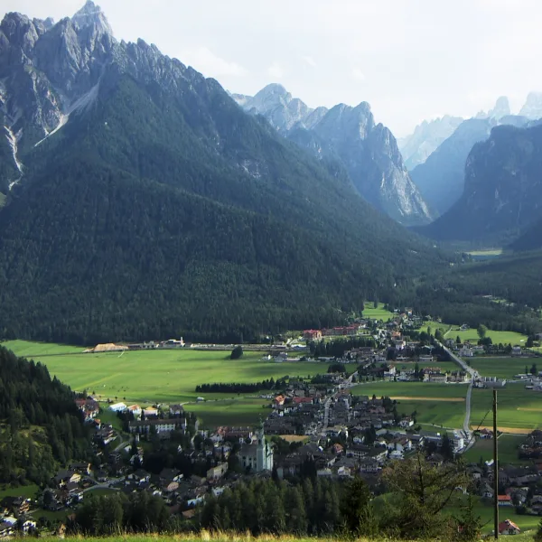
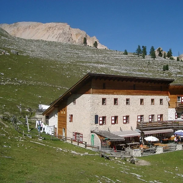
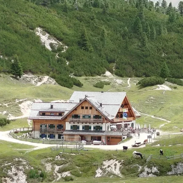
The AV1 traverses this zone on its second and third days. After departing Lago di Braies and ascending to Rifugio Sennes at 2,126 m6,975 ft (Day 1), hikers descend through the Val de Mareo to Rifugio Pederü before climbing back up to the Fanes plateau - one of the most remote and geologically striking sections of the entire route. The flat-topped limestone plateau sits between 2,000 m6,562 ft and 2,200 m7,218 ft, ringed by sheer walls on three sides, with the huts clustered at its northern end.
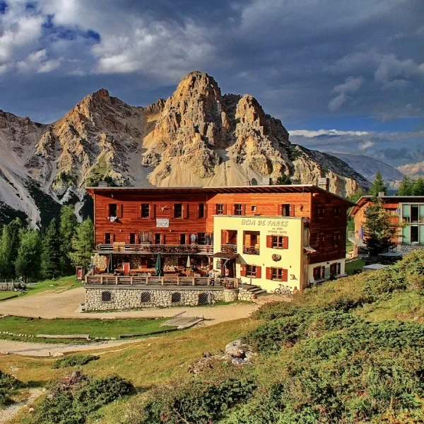
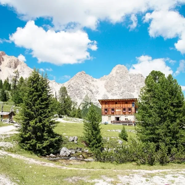
Day 2 ends at either Rifugio Lavarella (2,050 m6,726 ft) or Rifugio Fanes (2,060 m6,759 ft). These two huts sit a short walk apart on the plateau and share a meadow setting beneath the Croda del Vallon Bianco. Rifugio Fanes is the larger and more historic of the two, and the classic choice; Lavarella is the practical fallback when Fanes is full. Book either by February for a July visit - these huts sell out within hours of opening their reservation systems.
Day 3 climbs south across the Pian de Gran Fanes, drops to the valley at Capanna Alpina, then makes the brutal 1,350 m4,429 ft ascent past Rifugio Scotoni (2,040 m6,693 ft) to reach Rifugio Lagazuoi. If you want to base in Corvara rather than commit to the full AV1 circuit, you can access the Fanes plateau via the Armentara meadows trail from La Villa or the Val di Fanes approach from Capanna Alpina - a round trip to the plateau and back takes a full day from Corvara.
What Does the Piz Boè Summit Actually Involve?
Piz Boè (3,152 m10,341 ft) is the highest point of the Sella Group and one of the few genuine summit experiences accessible to non-climbers in the central Dolomites. The route from Corvara uses the Sass Pordoi cable car (departing from Passo Pordoi at 2,239 m7,346 ft, roughly 12 km7.5 mi by road from Corvara) to reach the top station at 2,950 m9,678 ft - already near the summit zone.
From the top cable car station, the path to Piz Boè follows a broad, rocky plateau known as the Vallon (Plan de Gralba) west and then north for roughly 2.5 km1.6 mi. The terrain is high-altitude limestone pavement, meaning no scrambling is required but the ground is uneven and the altitude effect is real. Allow 1.5 hours from the cable car for the round trip to the summit cairn and back.
Three critical facts about this route:
- Weather window: The Sella Group plateau builds cumulus clouds from noon onwards throughout July and August. Aim to be on the summit by 10:30. Storms here arrive with almost no warning.
- Sass Pordoi cable car hours: The gondola typically runs from mid-May to early November (2026 season: 14 May - 1 November). Out-of-season visits are on foot from the Pordoi pass, adding 700 m2,297 ft of ascent each way.
- There is a rifugio near the top: Rifugio Boè sits below the summit at roughly 2,873 m9,426 ft and serves hot meals - but prices reflect the altitude and the supply helicopter that stocks it. Expect 12-16 EUR$13-18 for a pasta plate. (Rifugio Capanna Fassa is a separate hut in the Val di Fassa near Canazei - do not confuse the two.)
What Are the Best Circular Day Hikes From Corvara?
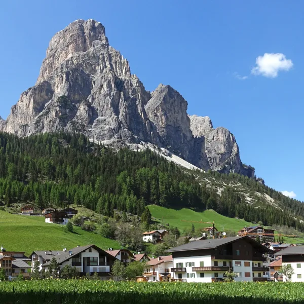
The Pralongià plateau northwest of Corvara is the closest high meadow terrain to the village, reachable in under an hour on foot. The plateau sits at approximately 2,000 m6,562 ft and offers a straightforward circular walk of 10 km6.2 mi with roughly 300 m984 ft of gain. The trail runs beneath the Sassongher rock tower - the signature geological landmark visible from every corner of Corvara - before looping back via the Pralongia chairlift station. This route works for families and for acclimatisation walks on arrival day.
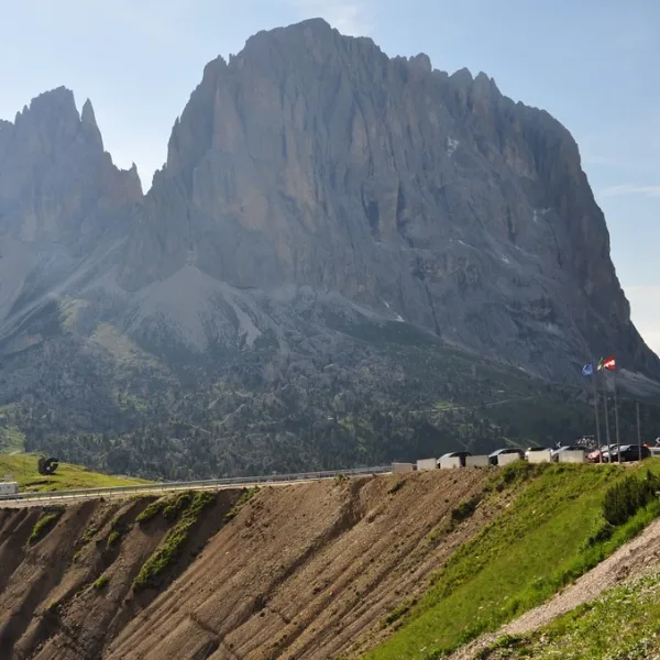
For a more serious full-day objective, the Vallon circuit below Piz Boè offers a high-altitude traverse combining the Sella Group plateau, the upper reaches of the Val Gardena Pass (Passo Gardena / Grödner Joch at 2,121 m6,959 ft), and a descent back to Corvara via the Boè valley. This is a 18-20 km11-12.4 mi route with 900 m2,953 ft of cumulative ascent - a serious day out, but technically no harder than any other plateau traverse in the Dolomites.
The Armentara high meadow trail above La Villa connects to the Fanes hut network. It climbs through flower-covered alps (the area is one of the best wildflower zones in the Dolomites from late June to mid-July) and reaches Ucia dles Muntagnoles after 600 m1,969 ft of climbing. From there, the Fanes plateau is a further 45 minutes across open terrain. This is the recommended approach for day-trippers who want to see the Fanes landscape without committing to the AV1 multi-day route.
Which Rifugi Should You Target Around Corvara?
The Val Badia and the surrounding Fanes-Sennes plateau host one of the densest rifugio networks in the Dolomites. These are the huts that matter for the AV1 stages and the Corvara day-hike network.
At 2,060 m6,759 ft on the Fanes plateau. The classic AV1 Day 2 hut, with a meadow setting beneath the Croda del Vallon Bianco. Books out within hours of reservation opening - target February for July nights.
At 2,050 m6,726 ft, a short walk from Rifugio Fanes on the same plateau. More dormitory space than Fanes and the practical fallback when Fanes is full. Same booking window applies.
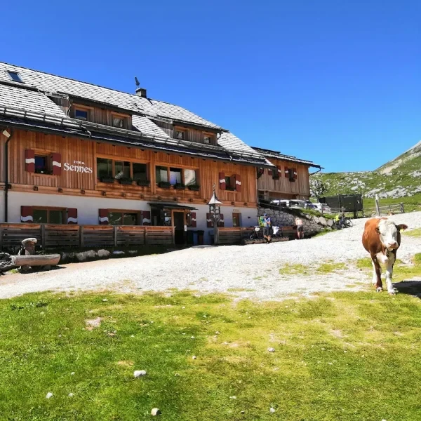
At 2,126 m6,975 ft on the Sennes plateau - AV1 Day 1 endpoint from Lago di Braies. South-facing terrace looking across to the Croda Rossa massif.
At 1,980 m6,496 ft on the eastern edge of the Sennes plateau. South-facing terrace and a quieter overnight option than Sennes or the Fanes huts.
At 2,176 m7,139 ft above the Sennes pastures. The most remote of the Sennes-area huts and the right choice if you want isolation rather than AV1 traffic.
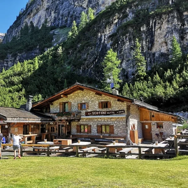
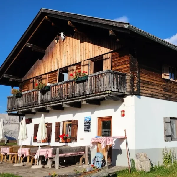
At 2,040 m6,693 ft on the AV1 Day 3 ascent toward Lagazuoi. The half-way coffee stop on one of the brutal climbs of the route. Lunch here rather than overnight unless you are splitting the day.
In the Armentara high meadows above La Villa. The natural day-hike target from Corvara when you want to sample the Fanes terrain without committing to a multi-day route.
For full hut booking procedures, etiquette, and what to expect overnight, see our rifugi guide and the mountain huts hub.
How Do You Get to Corvara?
The Val Badia road from the north connects to Bruneck (Brunico) via San Lorenzo. Direct buses (line 460) run from Bruneck train station to Corvara throughout the summer season - the journey takes approximately 40 minutes and runs hourly throughout the day. Bruneck sits on the Bolzano-Innsbruck rail corridor, making it the main rail gateway for Alta Badia arrivals from both Austria and central Italy.
From the east, the approach via San Candido (Innichen) and the Sesto valley connects to the Dobbiaco/Niederdorf junction and then south via Bruneck. There is no direct bus from San Candido to Corvara - you transfer at Bruneck. The San Candido to Bruneck leg takes approximately 40 minutes by train, with connections to the Val Badia bus service at the station.
Private car: Corvara is accessible via Passo Campolongo (1,875 m6,152 ft) from the Arabba direction, or via Passo Gardena from the Val Gardena. Both passes become congested on summer weekends. The Passo Gardena road is one of the four classic Sella Ronda passes, so expect cycling and motorbiking traffic from June through September. Parking in Corvara itself is limited - plan to use the lower village lots and walk up.
Cable car connections: In summer, gondola links from Corvara connect north into the Badia valley system. The Boè cable car connects south toward Passo Gardena and the Val Gardena. This cable car infrastructure makes it possible to reach huts above 2,500 m8,202 ft without significant valley-floor effort.
For a full overview of transport logistics to the Dolomites, see our complete logistics guide.
When Is the Best Time to Hike in Alta Badia?
The hiking season in Alta Badia runs from mid-June to late September, identical to the broader Dolomites calendar. However, at Corvara’s elevation of 1,568 m5,144 ft, the higher surrounding trails can stay snow-covered well into the second week of June, and the Fanes plateau sees reliable snow clearance only around June 20th-25th in a typical year.
July and August are the busiest months. The Corvara valley fills with Sella Ronda cyclists and hikers simultaneously. The Piz Boè summit route and the Fanes plateau trails see their peak use in these weeks.
Early September is the standout choice: the afternoon thunderstorm pattern eases from its July-August peak, the Sella Group is free of most cyclists as the summer road-biking season winds down, and the marmot colonies on the Fanes plateau are most active before hibernation. Hut bookings remain essential - the rifugi in the Fanes area close by late September, so avoid planning a Fanes visit after October 1st.
For full seasonal guidance, see our best time to visit the Dolomites guide. If you are comparing Alta Badia with other hiking bases, our sister post on Cortina d’Ampezzo covers the western approach to the same AV1 stages.
Other hiking bases worth comparing: Ortisei in Val Gardena for Alpe di Siusi access, San Candido for Tre Cime, and Dobbiaco for the AV1 starting point at Lago di Braies. For everything you need to know about staying in rifugi during your hike, our mountain hut guide covers booking, etiquette, and what to expect. Compare all five town bases side by side in our Best Towns for Hiking guide.