Why is Cortina d’Ampezzo a great base for hiking the Eastern Dolomites?
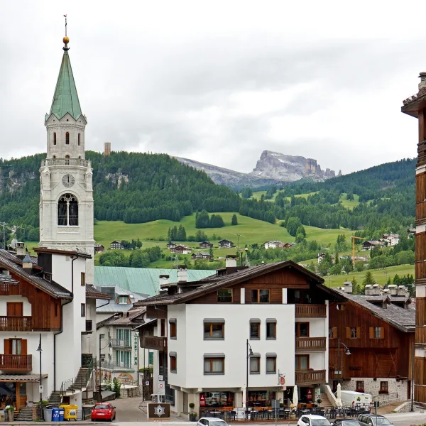
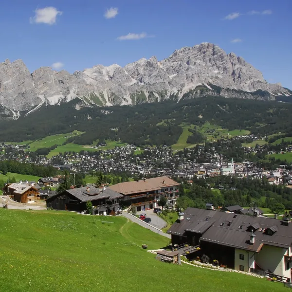
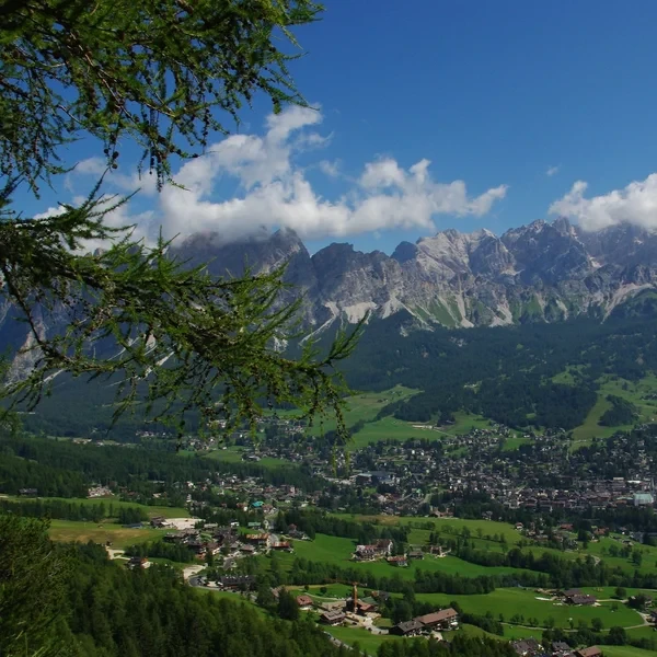
Cortina d’Ampezzo sits at 1,224 m4,016 ft in the Boite valley, encircled by five distinct mountain groups - the Cristallo to the north, the Tofane to the west, the Cinque Torri and Nuvolau plateau to the southwest, the Croda da Lago to the south, and the Sorapis group to the east. No other town in the eastern Dolomites gives you this range of terrain within a single day’s reach without moving your accommodation.
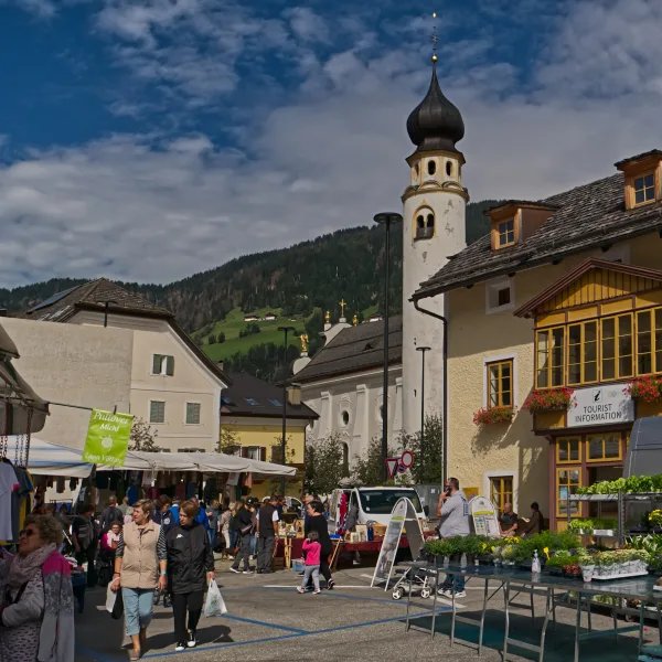
The town earned its international profile from the 1956 Winter Olympics and is hosting events for Milan-Cortina 2026. That infrastructure - expanded roads, cable cars, and reliable bus connections to Venice - works entirely in your favour as a summer hiker. Ignore the luxury hotel branding. Cortina is, at its core, a mountain town built for access.
The surrounding peaks are part of the Ampezzo Dolomites Natural Park, which means the trail network is well-signposted, patrolled, and maintained to a higher standard than more remote areas of the Dolomites. You will not find yourself navigating faded paint on crumbling scree here.
What Elevation and Geography Do You Need to Know About Cortina?
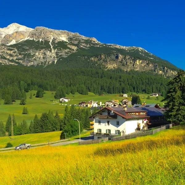
The town itself sits at 1,224 m4,016 ft - this is the cortina altitude you will see quoted everywhere, and it is accurate for the main piazza. The valley floor is broad and flat by Dolomite standards, carved by glacial action and bisected by the Boite river. The surrounding ridgelines and summit plateaux range from 1,800 m5,905 ft to over 3,000 m9,843 ft.
This starting elevation matters for two reasons. First, trail heights are easier to reach: taking a cable car from Cortina to 2,300 m7,546 ft is a gain of only 1,076 m3,530 ft, which most lift systems here cover in under 20 minutes. Second, acclimatisation is less of an issue than it would be arriving from sea level directly into the high mountains - one afternoon in Cortina is usually enough before tackling full-day routes.
The geology is classic Ampezzo Dolomites: pale grey and ochre limestone towers erupting from dark forest and alpine grassland. Unlike the western Dolomites around Bolzano, which have a more layered plateau character, the Cortina area features more isolated spires and vertical faces - ideal for dramatic viewpoints from the trail.
Which Hikes Should You Do From Cortina?
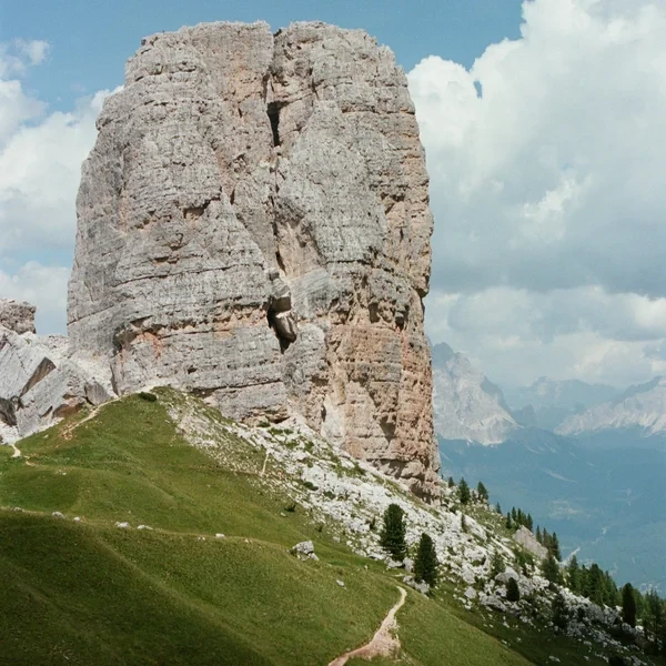
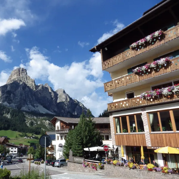
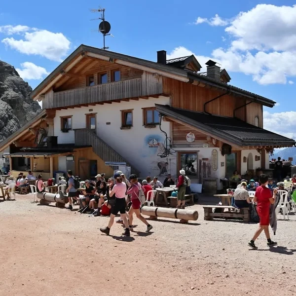
The Cinque Torri circuit is the single best introduction to the Cortina area. Five freestanding limestone pillars at 2,361 m7,746 ft, surrounded by restored WWI trenches from the Italian-Austrian front. Rifugio Scoiattoli and Rifugio Averau are both on the circuit - have lunch at one of them and you have the makings of a full day. The Rifugio Nuvolau perched at 2,575 m8,448 ft adds serious elevation if you want a harder objective. Access is via the 5 Torri chairlift from Bai de Dones on the SS48 road - no car needed if you take the Dolomiti Bus from town.
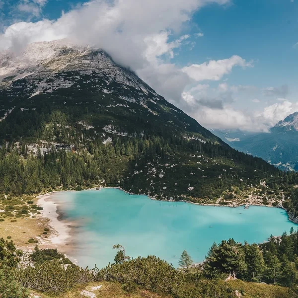
The Lago di Sorapis trail is the most technically demanding hike accessible from Cortina and the one most visitors underestimate. The lake sits at 1,928 m6,325 ft and owes its improbable turquoise colour to glacial rock flour suspended in the water. The approach involves fixed-chain sections and a narrow ledge traverse above exposed drops. This is not a beginner route. Budget 5 to 6 hours round trip, bring a helmet if you have one, and do not attempt it in wet conditions. The trailhead at Passo Tre Croci is on the SS48 east of Cortina - reachable by bus or car.
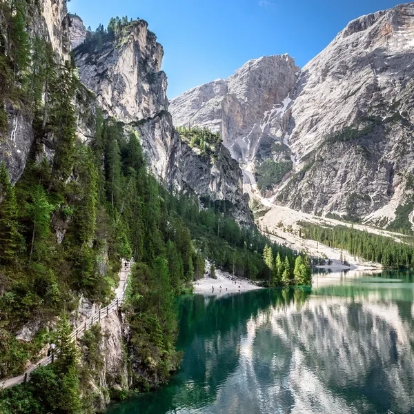
Lago di Braies (Pragser Wildsee) is not directly above Cortina but is the most visited lake in the Dolomites and a natural pairing with a Cortina base. The lake sits roughly 47 km29.2 mi northwest via the Val Pusteria, about 1 hour 15 minutes by car. The flat circuit around the lake takes under 2 hours. Private vehicle access is restricted from late morning to mid-afternoon in high season - check the current booking requirements before you go.
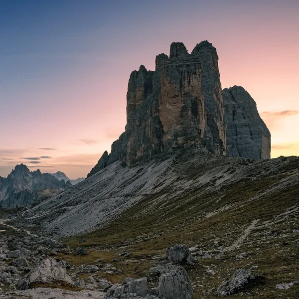
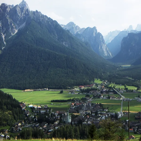
The Tre Cime circuit starts from Rifugio Auronzo, reached by a toll road from Misurina (roughly 14 km8.7 mi east of Cortina, then a further 7 km4.3 mi up the toll road). The three towers - Cima Grande, Cima Ovest, and Cima Piccola - are the defining image of the Dolomites. The 10 km6.2 mi loop starting from Rifugio Auronzo at 2,333 m7,654 ft is moderate, not easy: the altitude means cold, wind, and rapid weather changes. Depart early and be off the high plateau before 14:00 in summer. If you are basing yourself in San Candido for the Tre Cime, see also our San Candido hiking guide.
Which Rifugi Are Worth the Detour From Cortina?
The Cortina area has an exceptional density of high-quality rifugi. These are the ones where the food, views, and accessibility combine well.
At 2,255 m7,398 ft on the Cinque Torri plateau, this is the most accessible full-service rifugio in the Cortina area. Reachable by chairlift in 20 minutes. Overnight beds book out by March.
A short walk above Rifugio Scoiattoli at 2,413 m7,917 ft, with a wider panorama taking in the Tofane group directly north. Good for a mid-morning coffee stop before continuing the Cinque Torri loop.
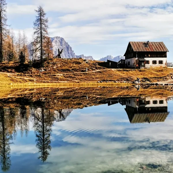
A longer approach from Cortina (roughly 90 minutes each way from the Campo di Sotto trailhead above town, through pine forest), but the reward is a private lake setting at the base of the Croda da Lago massif. No cable car access - you walk in. Fewer crowds than the Cinque Torri rifugi.
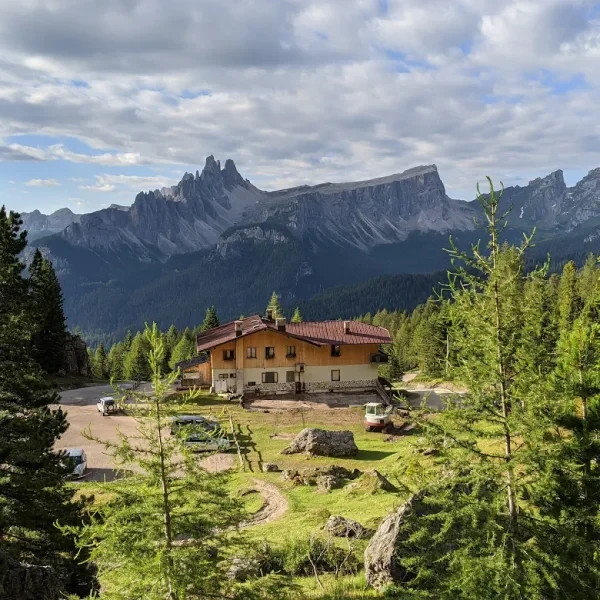
Named after the legendary Cortina guide Angelo Dibona, this hut sits at 2,083 m6,834 ft at the western base of the Tofane massif. The terrace looks out across the Boite valley. Reached by a short forest road from the Cortina-Falzarego highway, with the final climb roughly 20 minutes on foot from the upper car park.
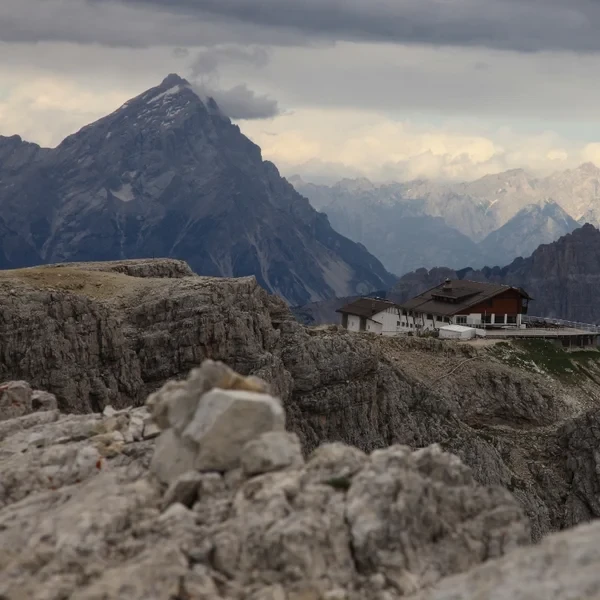
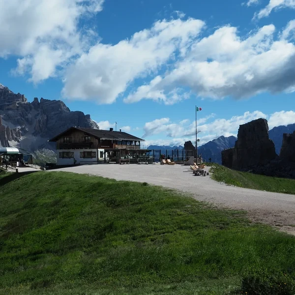
The highest rifugio on this list at 2,752 m9,029 ft, perched on a WWI summit accessible by cable car from Passo Falzarego. The view spans from the Tofane to the Marmolada glacier. Book well in advance - overnight beds here are the most sought-after in the entire Cortina area.
For a full overview of how rifugio booking works, what to bring, and what to expect, read the mountain hut guide.
How Do You Get to Cortina d’Ampezzo?
Cortina has no train station. The nearest railhead is Calalzo di Cadore, 35 km21.7 mi south. From there, Cortina Express and ATVO buses make the connection in about 45 minutes. Trains from Venice Santa Lucia to Calalzo run roughly twice daily and take around 2 hours 30 minutes.
The more direct option from Venice is the Cortina Express service, which runs directly from Venice Marco Polo airport (VCE) to Cortina in approximately 2 to 3 hours. No train change required. Service is more frequent in July and August.
By car from Venice: take the A27 autostrada north to Longarone, then the SS51 through the Cadore valley. Total distance: 160 km99.4 mi, driving time 2 hours without traffic. The SS51 is the main artery into Cortina from the south - there are no tolls on the mountain section. From the north (Innsbruck), approach via Dobbiaco and the SS51 through Carbonin.
The full logistics breakdown for getting to any part of the Dolomites is in our complete transport guide.
When Should You Hike From Cortina?
The hiking season runs from early July to late September. Outside this window, most cable cars are closed and many trails at altitude are snow-covered or icy. The specific dates vary by year and altitude.
July is when the full season opens. Trails are clear by the second week in most years, rifugi are staffed, and the meadows are at peak green. Afternoon thunderstorms are common - start hikes by 07:30 and be below the ridgeline by 13:00.
August is the busiest month by a wide margin. The Cinque Torri parking lot fills before 09:00. Rifugio Scoiattoli terrace is crowded by 11:00. The Lago di Sorapis trail sees queues at the chain sections. If you have flexibility, avoid the first three weeks of August.
September is the best month to hike from Cortina. Crowds drop sharply after the Italian school holidays end in the first week. The light is lower and warmer, the larch trees at 1,600 m5,249 ft begin turning gold from mid-September, and rifugi are no longer booked solid. Temperatures are cooler - pack a proper insulating layer, as mornings can be close to freezing above 2,000 m6,562 ft.
For a broader look at seasonal conditions across the entire Dolomites range, see the best time to visit the Dolomites.
Where Should You Base Yourself in the Cortina Area?
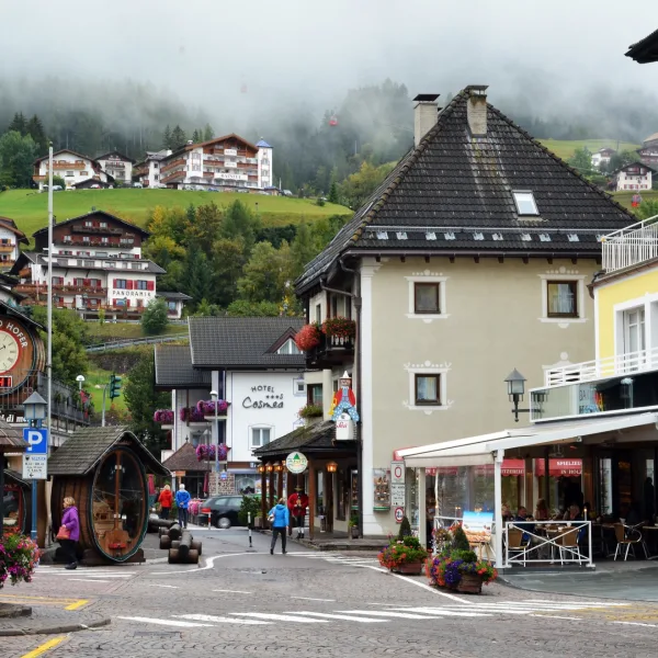
Cortina town centre is the practical default. The piazza is at 1,224 m4,016 ft, all bus lines terminate here, and the concentration of restaurants, supermarkets, and gear shops is unmatched in the eastern Dolomites. If you are arriving by bus from Venice, you have no logistical reason to stay anywhere else.
Pocol, a hamlet 4 km2.5 mi southwest of town at 1,535 m5,036 ft, is worth considering if you have a car and your primary objective is the Cinque Torri and Falzarego area. You save 30 minutes of driving each morning. It is quieter, cheaper, and has direct trail access. The downside: no shops, limited restaurant options, and you are dependent on your own transport.
Misurina, 14 km8.7 mi east of Cortina at 1,754 m5,755 ft, is the best option if Tre Cime is your main target. The toll road to Rifugio Auronzo starts at the lake. Accommodation here fills quickly - book at least 3 months ahead for July and August.
For hikers planning to explore the broader eastern Dolomites, Cortina pairs well with a night in Dobbiaco (Toblach) to the north - see our Dobbiaco hiking guide - or with the Alta Badia valley to the west, covered in our Alta Badia and Corvara guide. For the Val Gardena area further west, the Ortisei guide covers the Seceda and Alpe di Siusi access. Compare all five town bases side by side in our Best Towns for Hiking guide.